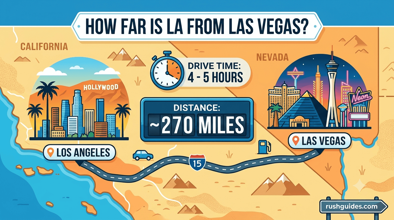
Los Angeles sits about 270 miles from Las Vegas by road, and depending on where you’re leaving from and which route you take, that number can swing anywhere between 260 and 282 miles. If you’re flying instead, the straight line distance drops to roughly 228 miles. Neither number tells you much about how long the trip actually takes once you factor in Cajon Pass traffic, a stop in Barstow, or a Friday afternoon exodus out of the city, so let’s get into what the drive, the flight, and every other option actually looks like.
The Quick Answer
Here’s the version you can screenshot before you leave the house.
| Method | Distance | Typical Time |
| Driving (Interstate 15) | 268 to 282 miles | 4 to 5.5 hours |
| Flying (straight line) | 228 to 229 miles | About 1 hour in the air |
| As the crow flies | 228 miles | N/A |
| Bus | 268 miles | 5 to 7 hours |
| Future high speed rail (Brightline West) | 218 miles | About 2 hours (once open) |
The gap between the road distance and the flight distance comes down to geometry. A plane can cut a straight diagonal across the Mojave Desert. Your car has to follow Interstate 15, which bends around mountains, cities, and the occasional stretch of nothing, adding roughly 40 miles to the trip according to Trippy’s distance calculator.
Driving From LA to Las Vegas
If you’re behind the wheel, expect the trip to run about 268 miles by road, including 212 miles on freeway, according to route data from Drivebestway. Other trackers land in a similar zone: Personal Sedan Services puts the range at 260 to 280 miles, with drive times of 4 to 5.5 hours depending on traffic and your final destination in LA, while the Air Miles Calculator’s routing tool clocks the driving distance closer to 282 miles with an estimated 5 hours and 16 minutes behind the wheel. The spread exists because “Los Angeles” isn’t one point on a map. Starting in Santa Monica adds miles compared to starting in Pomona.
The Route You’ll Actually Take
Almost everyone runs the same path. You take Interstate 10 East out of Los Angeles and connect to Interstate 15 North, which is the most direct route and also one of the more scenic drives in the Southwest, passing through San Bernardino, Barstow, and Primm along the way. It’s a simple drive with almost no turns once you’re on the highway, which is part of why so many Southern Californians treat Vegas as a casual weekend option rather than a full vacation.
How Long It Really Takes
Without stopping, most drivers clear the trip in about 4 hours. Real world numbers land a bit higher once you add traffic and pit stops. Las Vegas Direct estimates the average drive at 4 hours and 15 minutes, with a straight through run possible in 3.5 hours if traffic cooperates. Timing matters more than people expect. Because most Southern Californians head to Vegas for the weekend, Sundays tend to be the worst day to drive back, with everyone hitting the road at once.
Cajon Pass is the one chokepoint worth planning around. Any accident or heavy weather there backs up traffic for miles, and it’s the section most likely to turn a 4 hour drive into a 6 hour slog.
Where to Stop Along the Way
The desert stretch between the two cities has genuine character if you’re not in a rush.
- Barstow, a historic Route 66 town roughly at the halfway point and a good spot to refuel and grab food
- Baker, home to the World’s Tallest Thermometer and a solid photo stop
- Calico Ghost Town, a restored 1880s silver mining settlement just outside Barstow
- Zzyzx Road, mostly famous for having the strangest name on the entire drive
- Seven Magic Mountains, a set of brightly colored stacked boulders just south of the Strip
The halfway point between the two cities is Barstow, sitting about 11 miles from the exact midpoint by road, with roughly 122 miles left to Los Angeles and 145 miles left to Las Vegas from there.
Fuel Costs and Practical Tips
Gas prices move constantly, so treat any dollar figure as a rough guide rather than gospel. As a ballpark, a car averaging 25 miles per gallon would burn about $60 in gas one way at typical pricing, which is cheap once you split it between passengers. One thing worth knowing before you go: there are stretches of Interstate 15 where you won’t see a gas station for up to 30 miles, so top off in Barstow rather than pushing through on fumes. Running your air conditioning at full blast the entire way through the desert can also stress an older engine, so cracking a window on the cooler stretches isn’t a bad idea if your car is on the older side.
Flying From LA to Las Vegas
For a trip this short, flying is more about convenience than speed once you count the airport time on both ends. Commercial flights between Los Angeles International Airport and Harry Reid International Airport run about 1 hour and 15 minutes in the air, though scheduled flight times you’ll see when booking are often listed closer to an hour. A Boeing 737 covers the straight line distance in about 27 minutes at cruising speed, but real flights take longer because planes follow set air corridors rather than a direct line.
Multiple carriers fly this route regularly, including Southwest, Delta, American, and Spirit, and prices swing hard depending on how far out you book and whether you’re flying on a weekend. If you’re only staying a night or two, the math often favors driving once you add up airport parking, security lines, and baggage fees on a trip that’s barely an hour in the air.
Other Ways to Get There
Bus
Budget travelers have real options here. Companies including Flixbus and Tufesa run the route regularly, and Las Vegas Direct notes that starting in 2026, GOGO Charter plans to offer fares under $10 connecting Las Vegas, Los Angeles, and Phoenix with multiple pickup stops. Buses typically take 5 to 7 hours depending on stops, longer than driving but with none of the parking headaches once you land on the Strip.
Luxury Shuttle or Private Car
If you’d rather not drive and don’t want to deal with an airport at all, private shuttle services fill that gap. Luxxpress runs Mercedes Sprinter shuttles between the two cities for roughly $70 to $80 per person, complete with power outlets and complimentary water. Split across a group, it can land close to what a flight costs per person, minus the security line.
The Future: Brightline West
There’s a real high speed rail project in the works, and it’s worth knowing where it actually stands rather than the marketing timeline you might have seen a couple of years ago. Brightline West broke ground in April 2024 and is building a 218 mile electric line running mostly in the median of Interstate 15, connecting Las Vegas to Rancho Cucamonga, where it will link into the Metrolink system for onward travel into downtown LA.
The project has slipped more than once. It was originally pitched as a showpiece ready for the 2028 LA Olympics, but Brightline told Nevada’s FOX5 in January 2026 that the line is now scheduled for completion by late 2029. As of March 2026, the company confirmed it was still waiting on a $6 billion federal loan needed to fund construction, while pursuing a separate $4 billion loan from a banking consortium at the same time, though surveying work along the entire route was already complete. Once it’s actually running, trains are expected to hit speeds up to 200 miles per hour and cover the trip in about 2 hours, roughly twice as fast as the average drive. Worth watching, not worth planning your next trip around just yet.
LA to Vegas by the Numbers
| Metric | Figure |
| Driving distance | 268 to 282 miles |
| Straight line (flight) distance | 228 to 229 miles |
| Average drive time | 4 to 4.5 hours |
| Average flight time | About 1 hour |
| Halfway point | Barstow, California |
| Main driving route | Interstate 10 to Interstate 15 |
| Estimated gas cost (one way) | Around $60, price dependent |
| Worst day to drive | Sunday evening |
FAQ
How far is LA from Las Vegas in miles? The driving distance is about 270 miles, though it ranges from roughly 260 to 282 miles depending on your exact starting point in LA and the route you take. The straight line, “as the crow flies” distance is about 228 miles.
How long does it take to drive from LA to Las Vegas? Around 4 hours without stopping. Add traffic through Cajon Pass, a food stop in Barstow, or weekend congestion, and the realistic window is closer to 4.5 to 5.5 hours.
Is it cheaper to fly or drive to Vegas from LA? Driving usually wins for solo travelers or small groups on short trips, since gas runs roughly $60 round trip split between passengers, while flights add airport parking, baggage fees, and time on both ends for a flight that’s only about an hour in the air.
What’s the best time of day to drive to Las Vegas? Avoid Friday afternoons heading into Vegas and Sunday evenings heading back to LA, both of which see the heaviest weekend traffic on Interstate 15.
Will there ever be a train between LA and Las Vegas? Yes, Brightline West is under construction and expected to open by late 2029, cutting the trip to about 2 hours once it’s running.
Whichever way you choose to make the trip, the desert between these two cities is short enough to knock out for a weekend without much planning. Book your flight early if you’re flying, gas up in Barstow if you’re driving, and either way, you’ll be on the Strip before you know it.
Read More About: Hotel Keralafonia